We are a global community of professional photographers and filmmakers driving conservation impact through ethical visual storytelling
Be a part of our conservation impact
Join Our Community of Conservation Photographers!
Discover inspiring stories and images from the front lines of conservation and be the first to receive opportunities to attend iLCP workshops, events, and exhibitions.
By submitting this form, you are consenting to receive marketing emails from: International League of Conservation Photographers (iLCP), 4600 N. Fairfax Drive, 2nd Floor, Arlington, VA, 22203, US, http://www.conservationphotographers.org. You can revoke your consent to receive emails at any time by using the SafeUnsubscribe® link, found at the bottom of every email. Emails are serviced by Constant Contact.
![]()
A global Fellowship
We are a global Fellowship of professional storytellers focused on conservation impact. Meet the Fellowship.
Top-tier photographers and filmmakers
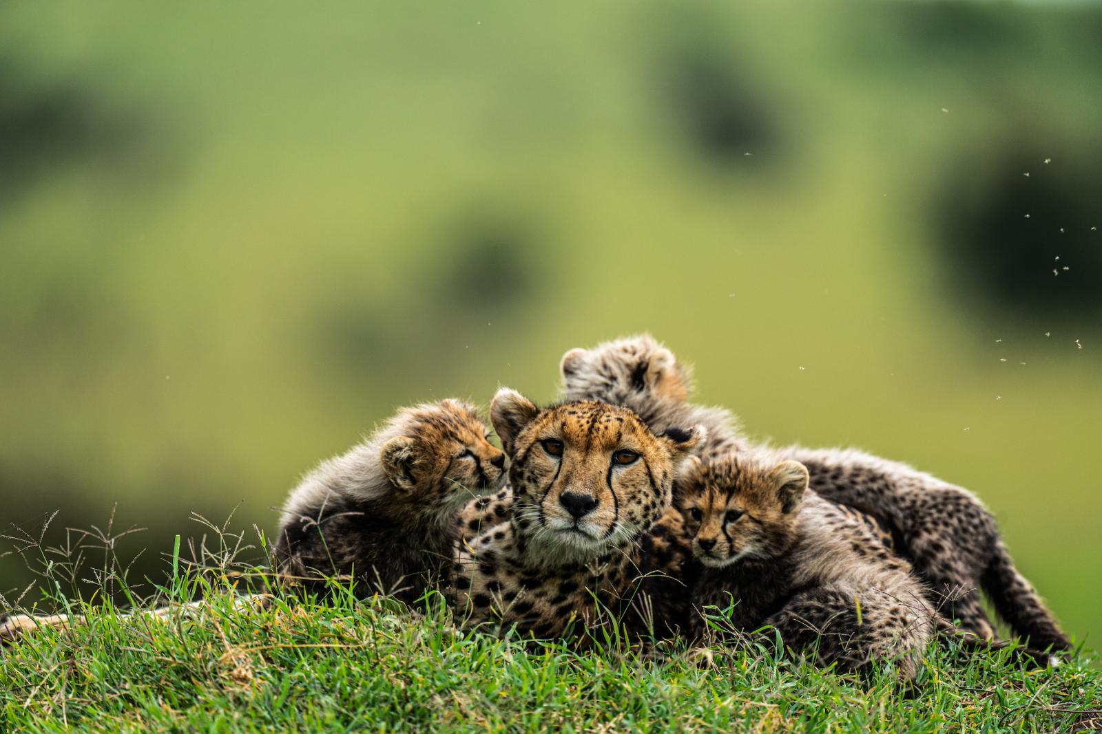
The iLCP Fellowship is made up of top-tier photographers and filmmakers using solution-based media as a catalyst for conservation efforts. With 120+ Fellows, based in 26 countries and working in 190 countries, our conservation impact has a global reach. They shine a light on issues ranging from endangered flora and fauna to climate change to ocean health.
What is Conservation Photography and Filmmaking?
In a visually-based society, conservation photography and filmmaking harnesses the power of storytelling to further conservation goals. These stories shed light on environmental and cultural issues, solutions, and efforts; with the goal of making a positive change in the Anthropocene.
iLCP News
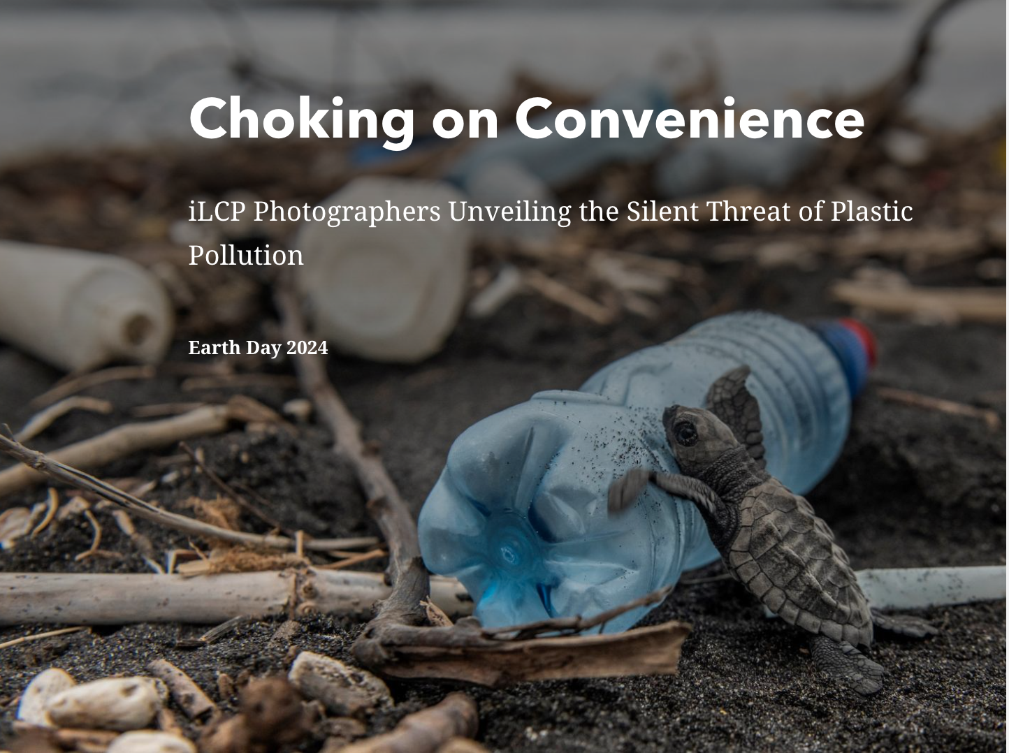
Earth Day 2024: A Planet Choking on Convenience
iLCP
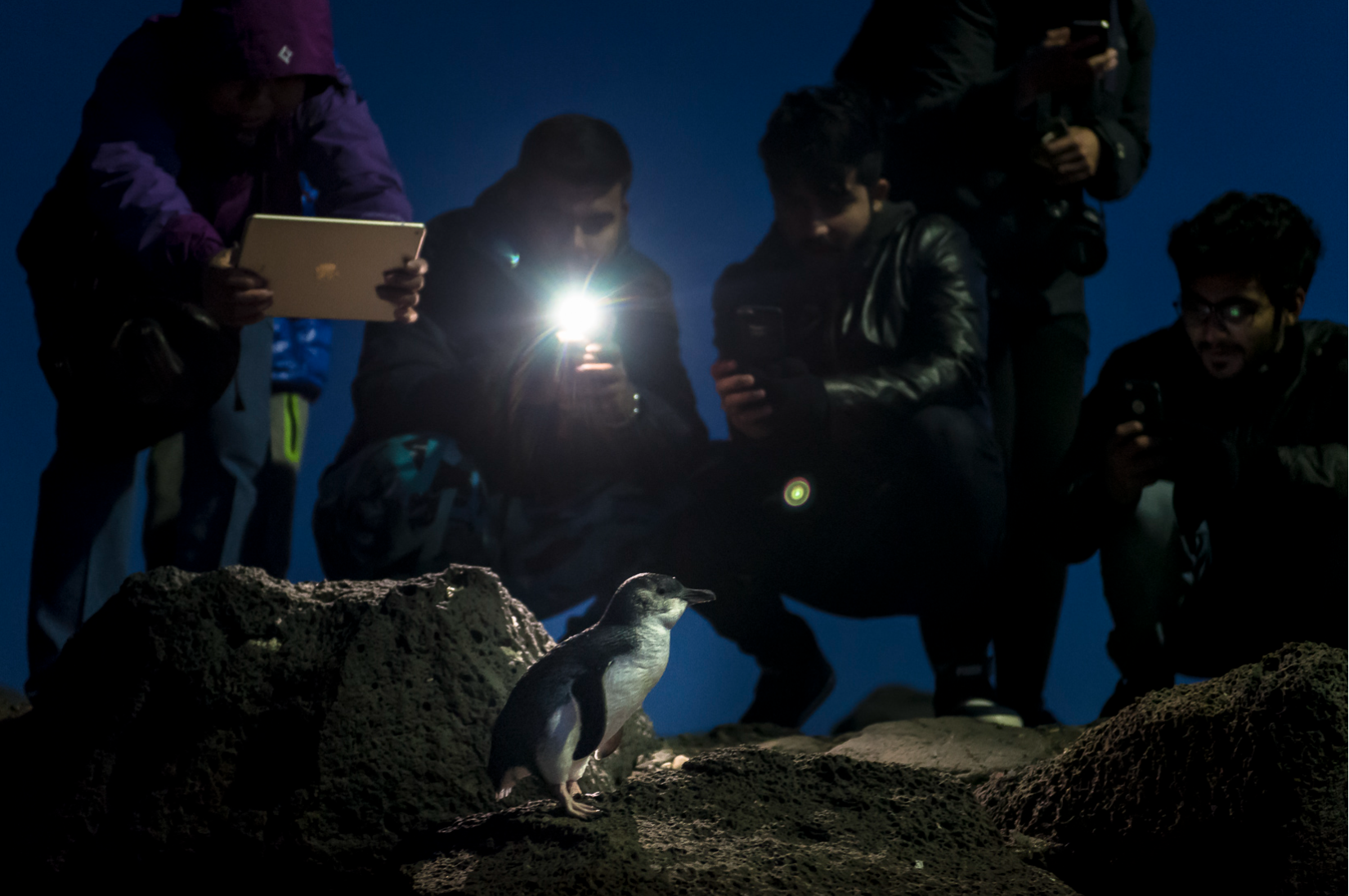
A Light Touch: Reflections on using additional light when photographing wildlife
iLCP
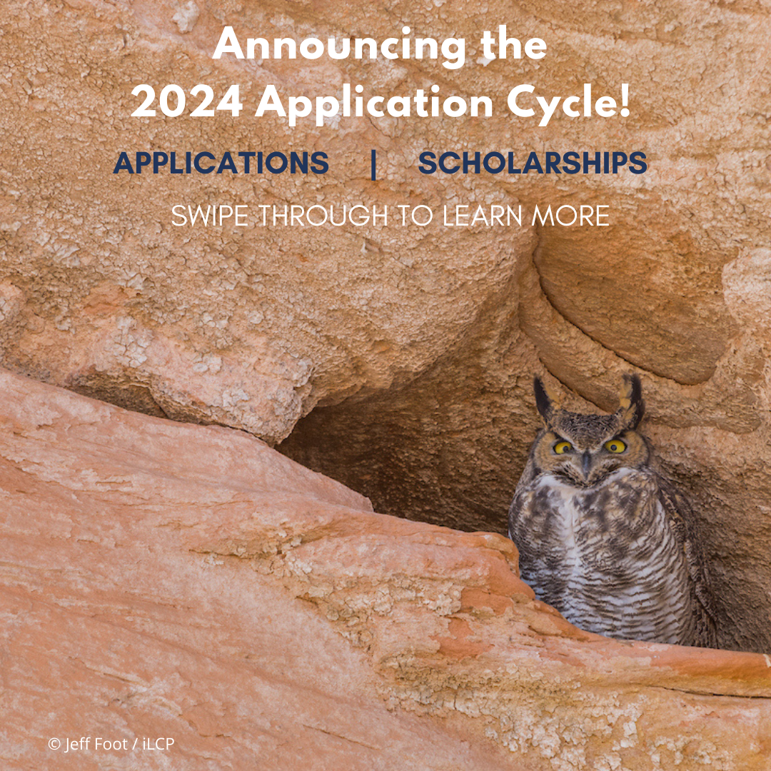
2024 Application Cycle
iLCP
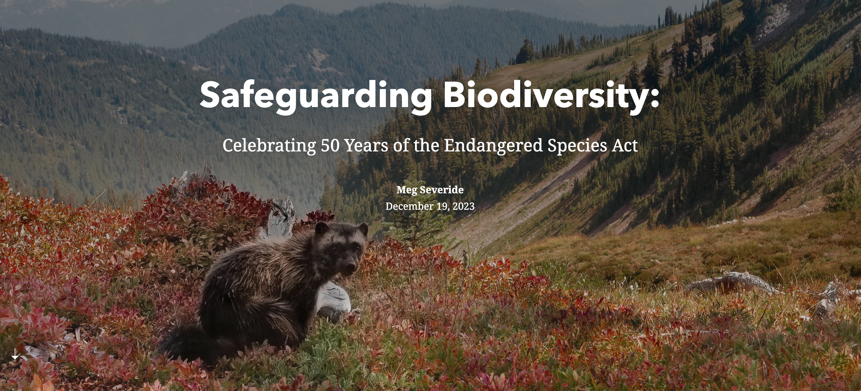
Celebrating 50 Years for the Endangered Species Act
iLCP
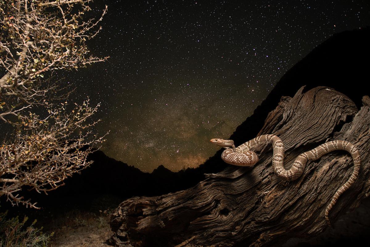
World Reptile Day Story Map
iLCP